NICEE Remembers the 1993 Latur Earthquake
on its 30th Anniversary
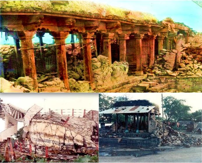
Thirty years ago, in the morning hours, a moderate earthquake (~M6.4) shook the Marathwada region of Latur and Osmanabad districts of Maharashtra. The event proved to be one of the deadliest earthquakes to have struck India in recent times which resulted in over 8,000 fatalities, 16,000 injuries, and over one million homeless people.
The region is geologically a part of the Deccan Plateau (Trap) which has been widely regarded as a stable continental region (SCR) for its limited potential for seismic activity as opposed to highly seismically active Himalayan plate boundary regions. The area that was in the lowest seismic zone was moved to Zone III, the third highest in the 2002 revision of the seismic code IS 1893.
The devastation was largely due to extremely vulnerable housing stock constructed of uncoursed random rubble stone masonry with heavy earthen roofs supported by timber planks and posts. About 67 villages around Killari in Latur district and contiguous areas were completely destroyed. The total property loss was approximately $333 million (Rs. 11.8 billion).
In response to the scale of the destruction, Govt. of Maharastra launched an equally massive reconstruction program, known as MEERP (Maharashtra Emergency Earthquake Rehabilitation Program). This program involved the relocation of 52 totally destroyed villages, the reconstruction of 22 severely damaged villages, and the repair/strengthening in about 2400 villages. The initiative placed a strong emphasis on rebuilding with better housing and infrastructure.
A few reconnaissance reports and published articles about the earthquake effects and reconstruction program are listed below for further information.
-
Slide show recalling the aftermath of the Latur Earthquake
https://nicee.org/Latur_EQ/slide_show/ -
Reports on the Latur Earthquake:
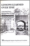
EERI: Innovative Earthquake Recovery in India
EERI: https://www.eeri.org/lfe/pdf/India_Maharashtra_Insert_Jan94.pdf
NICEE: https://www.nicee.org/Killari.php
NICEE: https://www.iitk.ac.in/nicee/readings/paper4.pdf
Current Science: A quick look at the Latur earthquake of 30 September 1993
Geophysical Research: The 1993 Killari Earthquake
Tectonophysics: An investigation into the Latur earthquake of September 29, 1993
Science: The Deadly Latur Earthquake
New Zealand Digital Library: The Earthquake of Osmanabad and Latur-Rescue and Relief Operation
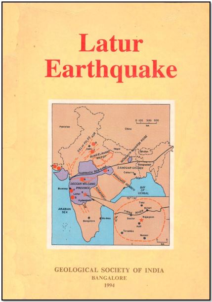
GSI: Latur Earthquake
Pls visit the following pages on NICEE for some more aspects of Earthquake Engineering
-
E-book version of Earthquake Tips:
https://www.nicee.org/ebook/EQTips_Eng/ -
Model building codes:
https://www.nicee.org/IITK-GSDMA_Codes.php -
IITGN-World Bank Project on Seismic Codes:
https://nicee.org/IITGN-WB_Codes.php -
Earthquake Engineering Education:
https://www.nicee.org/npeee -
Confined Masonry Construction:
https://www.nicee.org/confinedmasonry.php
Durgesh C Rai
Coordinator,
National Information Center of Earthquake Engineering (NICEE)
IIT Kanpur