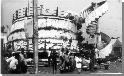
The 1993 Killari earthquake in central peninsular India is the latest intracratonic event to be responsible for a large disaster.  The positive side of this tragedy is that it will provide new insights into geologic, engineering and cultural factors that control the distribution and degree of damage, which will aid in turn the development of a more effective hazard reduction program for peninsular India and similar intrapolate environments. The positive side of this tragedy is that it will provide new insights into geologic, engineering and cultural factors that control the distribution and degree of damage, which will aid in turn the development of a more effective hazard reduction program for peninsular India and similar intrapolate environments.
This report summarizes our observations during a ten-day investigation of the mesoseismal area of the 1993 Killari earthquake. Several aspects of the earthquake were investigated, ranging from the surface rupture and related deformation to the pattern of damage to engineered and traditional structures. Finally, the rescue and reconstruction efforts following the earthquake brought out important issues that are generally relevant to earthquake hazard reduction in traditional rural settings; these are also briefly discussed.
Key Information
Location:
Centered near the village of Killari, Latur district, Maharashtra State, Central India (18.2N; 76.4E)
Main Shock Source Characteristics (USGS):
00:03:53 local time, September 30, 1993 (22:25:53 GMT, September 29); Ma = 6.4; Mb= 6.3; Mw= 6.1; centroid depth = 5km; moment tensor solution yields an almost pure thrust with quasi-horizontal P axis striking N31° E.
|